استصلاح الأراضي والتنمية الزراعية المستدامة

نقدم حلولاً مبتكرة لاستصلاح الأراضي وتحقيق التنمية الزراعية المستدامة.

من نحن في ريم لاند

نحن شركة متخصصة في استصلاح الأراضي والتنمية الزراعية، نستخدم تقنيات مبتكرة لتحقيق الاستدامة وتلبية احتياجات المستثمرين والمزارعين.

An aerial view of agricultural fields with a river cutting through the landscape. The fields are divided into rectangular patches, some covered with dark-colored materials, possibly solar panels or greenhouses. Several boats are visible on the river, suggesting transportation or trade activity. Infrastructure like roads and buildings are also visible, indicating human settlement and development.
رؤيتنا ورسالتنا
قيمنا الأساسية

نسعى لتقديم حلول زراعية متكاملة تشمل الطاقة الشمسية وحفر الآبار، لضمان تحقيق التنمية المستدامة وتحسين الإنتاجية الزراعية.

خدماتنا المتكاملة

نقدم مجموعة شاملة من خدمات الاستصلاح والتنمية الزراعية لتحقيق أقصى استفادة للعملاء.
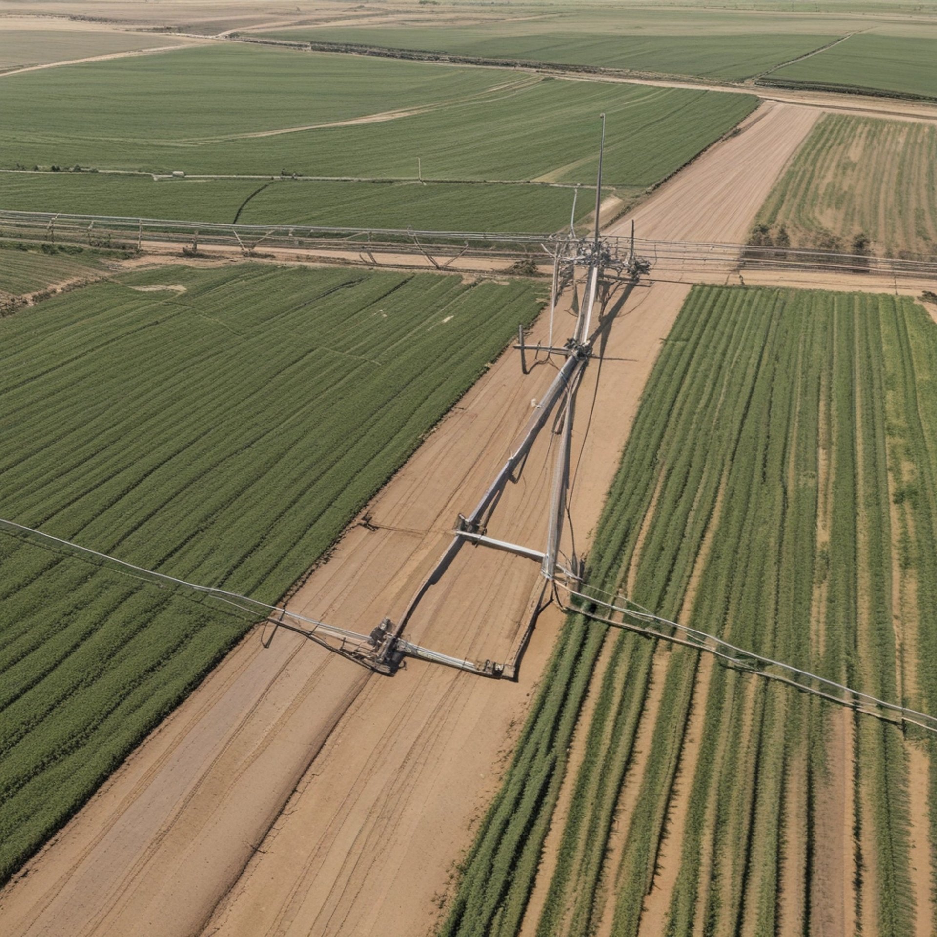
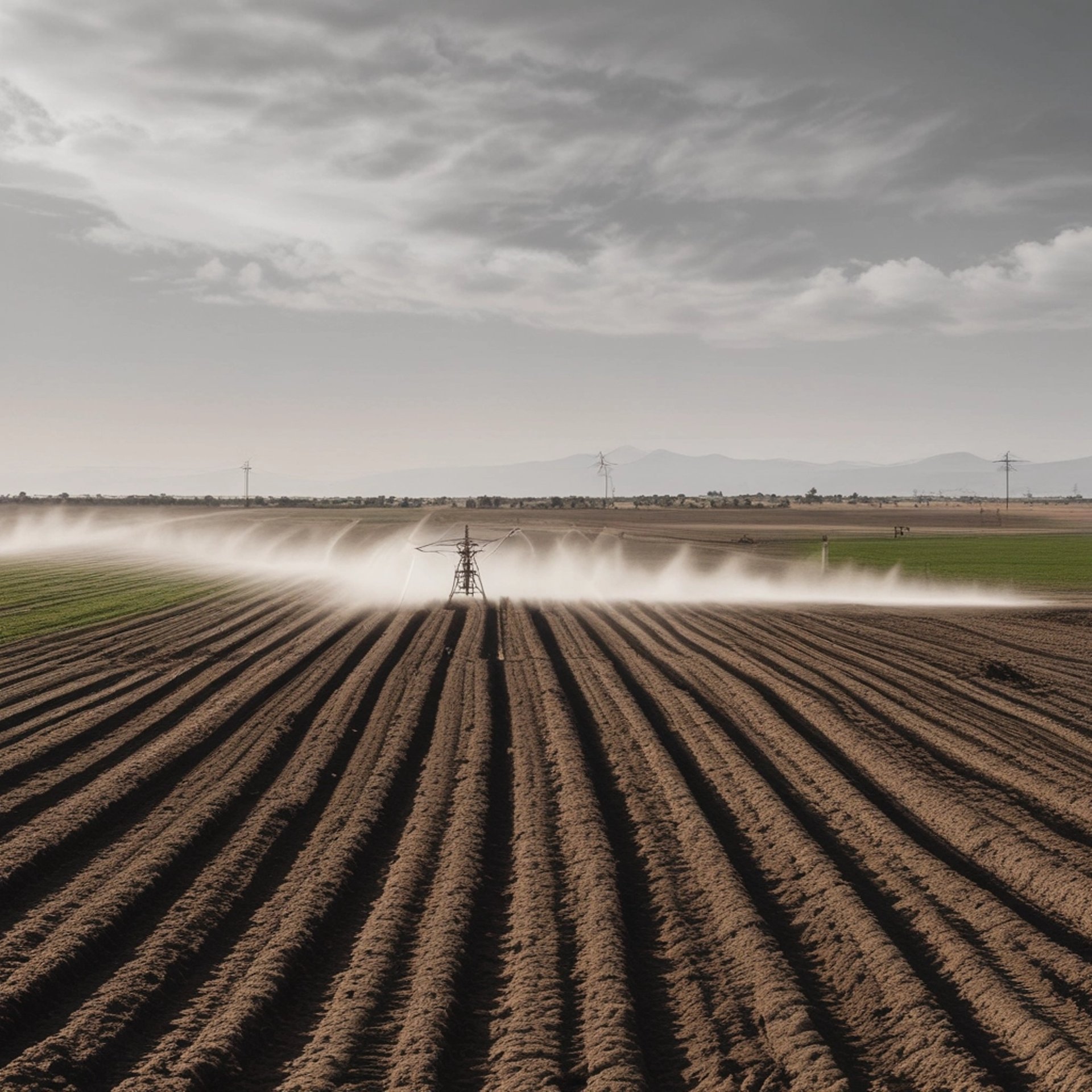
An aerial view of expansive farmland divided into various rectangular and circular plots. The fields vary in color and size, indicating different stages of cultivation or use. Sparse buildings and farmhouses are scattered across the landscape, connected by a network of dirt roads. The land appears dry and barren, possibly indicating an arid climate.
Aerial view of circular agricultural fields set in a desert landscape. These circular patterns are likely created by center-pivot irrigation systems. The surrounding area appears arid and sparse, showing a contrast between the green of the fields and the brownish tones of the land.
الاستصلاح الزراعي

تحويل الأراضي غير الصالحة للزراعة إلى مزارع منتجة باستخدام تقنيات مبتكرة ومستدامة.

تقسيم الأراضي

تصميم الأراضي الزراعية لتلبية احتياجات المستثمرين والمزارعين وفق أعلى المعايير العالمية.

معرض

استكشف مشاريعنا في استصلاح الأراضي والتنمية الزراعية.

An aerial view of a neatly divided landscape with a large section of lush green fields occupying the upper portion, marked by faint, parallel tracks likely from agricultural machinery. Below, a smaller area of brown, tilled soil is visible, indicating a transition between cultivated and uncultivated land.
An aerial view of vast agricultural fields organized in a grid-like pattern. The fields are divided by straight roads and irrigation channels, creating rectangular sections. The landscape appears flat, with variations in color indicating different crops or land usage.
An aerial view of an agricultural landscape with rectangular plots of land, some filled with water indicating rice paddies. There are various shades of green vegetation and a few scattered small structures. A dirt road runs through the scene, with trees and bushes lining the plots.
An aerial view of a tractor on agricultural land, cultivating a field with visible tire tracks and variations in soil color. Adjacent to the field is a paved road bordered by grass, with a distinct contrast between the cultivated and uncultivated areas.
A vast agricultural landscape featuring lush green fields in the foreground and golden wheat or grass fields beyond. In the distance, there are clumps of trees and palm trees, with a backdrop of mountains under a clear blue sky. A small cluster of buildings can be seen to the right.